Showing posts with label McKenzie Pass. Show all posts

Sunday, June 12, 2016

Easy Hike to Blue Pool on the McKenzie Pass


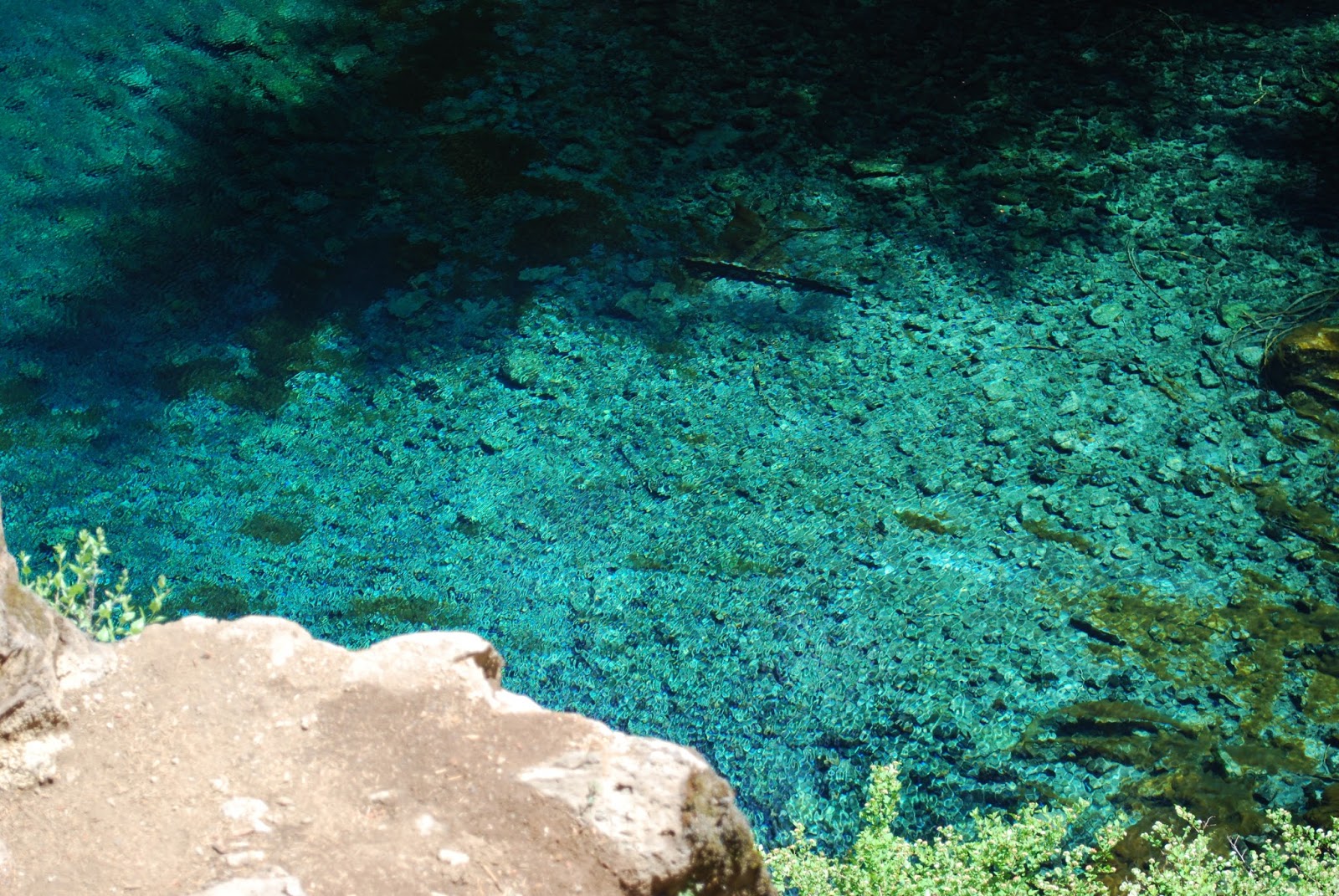
Blue Pool

We couldn't decide where to go for a hike, so we went back to Blue Pool. We did this hike back in 2014. We really liked it. I was bummed because we didn't see a waterfall then. The book shows a picture of a waterfall, but apparently there's a dam that makes it so there's no more waterfall. 


The hike itself is pretty easy, but the terrain is a bit rocky. I kept tripping over rocks. We decided not to bring our poles since we both remembered it being a fairly easy hike, but I was kind of regretting not having my poles because I almost went face first a few times. I never did actually fall, but there was at least one time that I thought I was going to end up landing on my hand and that was going to hurt. I might need to start wearing gloves when I hike. My skin is so sensitive and I'm such a wimp when it comes to bruises. 


The parking lot isn't that big for this hike, but there's a lot of space that people turn into parking spaces on the road. This is a very popular hike. Bikes can also go down this path. I don't think they can go up it though. I'm not really sure of the whys on that, but I think those are the rules We had to pull over a lot to let bikes pass and several times to let people pass since the path isn't really wide enough for groups of people to pass each other. We got a late start on the hike too so a lot of people were coming down as we were going up. 


There are two bridges on this trail. They can be a bit slick so be careful. I'm not sure how many feet in elevation this hike has because both of my apps differ and they different from the book as well. I do remember going up this thing thinking that I shouldn't have found this hike to be Easy back in 2014. It wasn't hard, and I had no problems with it this time, but two years ago, I feel like I would have found considered it Easyish which means easy for fit people and a little challenging for those of us who are 100 pounds over weight. This time around, we didn't stop to take a breather going up. We stopped for pictures, but we never stopped because we just couldn't continue anymore. I guess that should be considered easy.


The terrain made it a bit tiring though. Way too many rocks to trip over. There was also a big tree that had fallen over the path. People had made their own path around the tree, but going over the tree wasn't really an option for us. The path around the tree was easy enough on the way up, but on the way down hubby had to help me a little bit. So the giant tree fell over the main path, but there was also a small tree or a branch off the big tree I'm not sure which that you had to climb over to get back out. On the way up, it's just a giant step down. Down is a lot easier than a giant step up since gravity helps you go down and it doesn't hep you go up. I took too long trying to decide if I could do it so hubby just stuck his hand on my butt and pushed. I kinda wanted to see if I could do it on my own, but that's what I get for taking too long. 


Overall, this is a great hike. I wouldn't go wearing flip flops and I wouldn't take toddlers unless you've got them in some sort of carrying device, but it's an awesome hike. There were people jumping into the pool while we were there which created some extra entertainment. If you want pictures without people in them, you might want to get there super early. We've been twice though and both times people were on the ground by the pool. If you want to get down there, you either have to jump in, or you can keep going past the pool and then follow a trail around the pool and then down to the pool level. We didn't do that. We'll probably do that the next time we are there. 


Polar M400 Screen Shots

I forgot my heart rate monitor at home, so it's just the GPS stuff this time. I'm pretty sure the elevation is a bit screwed up on this since I know we didn't go 840 feet up. 


I'm not really sure why this looks like it does. That spike at the halfway point shouldn't be there and the beginning part should look more like the end part or the end like the beginning since it was an out and back. This is what drives me crazy about all of these devises! 

Gaia GPS 

Here are the screen shots from Gaia GPS. The elevation looks a little bit more realistic on this one. However, it still shows that I went up higher than I came down, but it was an out and back. I walked up and then I walked down. It should be the same up and down. The max speed of 8.1 is not accurate either. I can't even run that fast. 


Sunday, May 1, 2016

First Outing of the Season! Walton Ranch and Fish Lake

The meadow that the elk are supposed to hang out in at Walton Ranch.

Walton Ranch 

I have missed hiking so much! I've been trying to get back into walking before work to get ready for hiking season. It works out some days, but not others. This week, I got out there three days in a row, but skipped Thursday and Friday. We had to go to Albany again this weekend, so we packed our hiking shoes and planned on hitting Soda Creek Falls on the way home, but decided to do Walton Ranch instead. It had been rainy all week so we didn't really feel like dealing with a muddy path for Soda Creek Falls. It's got some slick spots on a good day, but after a week of rain, we just didn't want to deal.


Walton Ranch is about a 1/4 of a mile. The trailhead sign said that it's got 240 feet of elevation gain, which surprised me because I thought it was all flat. I was a little concerned about 240 feet over only 1/4 mile, but it turned out to be very gentle. There was a switchback or two. It was a wide enough path for two people to walk across if you're not as wide as hubby and I. The path was well maintained and held up well even with the rain. Elk are supposed to hang out from December to May. We went on April 30th, but didn't see any elk. However, we were there in the middle of the day. I would imagine, you'd have better success if you visited in the early morning or at dusk. Maybe we'll try again on our way to Albany next time and see if we can get a peek of some elk. Maybe we'll wait until December though. Who knows!

The viewing platform at Walton Ranch.


Anyway......This isn't really much of a destination hike. If you're driving by, it's a nice little spot to stretch your legs out, but I wouldn't make the drive just to see some green grass. There are benches set up along the way even though you probably won't need them, nor would you want to sit on them if it's muggy and wet. There was a viewing platform at the top. It had some informational signs that talked about the history of elk in the region. At the right time of year, it might be a more scenic trip with some flowers, but flower season isn't elk season. We did get to see a couple flowers.


You can find Walton Ranch on Hwy 20 between Sweet Home and the Junction with Hwy 22. It's at the same spot as the Trout Creek Trailhead that takes you to Rooster Rock. There's also a Rooster Rock Trailhead, but that's not the one you want if you want to go to Walton Ranch.


Fish Lake with water April 20, 2016

Fish Lake Remount Depot

This was our second time visiting Fish Lake. The first time was last year I think. I apparently didn't do a blog post about it which irritates me, but I was able to find the pictures from last year. The picture isn't from the same exact angle, but you can tell that it's the same place by the butte in the back and the trees are pretty much the same on the left side. The right side trees are a big different, but it's been a year and the angle wasn't the same. Isn't that crazy? What's really crazy though is that fish live in that lake when there's water in it. Apparently, they sense the warming water and know the lake is going to dry up, so they move to a creek that feeds into the river. That's what the informational sign said.

Fish Lake without water May 31, 2015

Okay so Fish Lake is one of those lakes that's only a lake for certain months of the year. It's supposed to be a lake through June or July. I forget which. So last year I think we went in May. However, it was a very grassy meadow during out trip. See all that water in the first picture? The lake is ginormous! Last year, we walked right through the middle of it and didn't even get our feet wet. There was grass seriously up to the middle of my shins or even taller in some place. We went back just to see if the place really did turn into a lake! It really does! 

The history grave site from our trip in 2015. We didn't walk to the grave this year.


There's not much to do here, but there are some picnic tables you can sit at and have lunch while looking at the lake. You can also check out the grave of an early settler. You can also check out the Remount Depot. There are some old building and corrals and stuff. It's cute and historic. 

The view inside the fence around the grave. Taken in 2015.


There's a viewpoint right off the parking lot and then you can go back and look at the Remount Depot. Once you go through the first gate, but before you go through the second gate, you can go left down a little path between a lava rock wall. The day we went, there was a tree blocking the path, but were able to get up and over the tree. At the end of the path, it looks like a bit of a boat ramp. However, it didn't look like it had been used recently. The giant tree blocking the path would also clue me into that fact, but anyway.......To get to the grave, go through the Remount Depot and up a gentle hill that didn't feel so gentle our first time doing it because it was like 90 degrees and 98% humidity! The grave isn't really all that exciting to look at, but it is a piece of history so you might as well check it out if you're there. 


There is a restroom here which is nice! I didn't go in it, but I'm assuming it's one of the vault toilets. I wish I had taken a picture of it though because it's super cute. It's probably odd to say that about a restroom, but it was cute. The vents for the rooms made it look like it was a smokehouse which made me laugh. 

The boat ramp at Fish Lake. Or at least that's what I think this is. 

Last year when we attempted this trip, we started on the Tombstone side, but we couldn't find the sign pointing to the trailhead. You're supposed to be able to hike a couple miles from the Tombstone side down to the Remount Depot along the Old Santiam Wagon Road. I'm glad we never found the trailhead because it was super hot and super humid. It was a pretty miserable day that day! The drive on the forest roads through was less than pleasant for me. Hubby liked it, but he's a guy so they are strange creatures. This time, we just turned onto HWY 126 and pulled into the parking lot. There are two signs for Fish Lake on Hwy 126. If you're coming from Eugene, you want the first one. If you're coming from Sisters, you want the second one. It's not that far from the split of Hwy 22 and 126. 

The second gate. The boat ramp is down the path to the left before this gate.

Overall thoughts......

I'm glad we finally made it to Walton Ranch. We've talked about going there several times, but have never made it. It's super short, but it was nice to stretch our legs and tackle a little bit of elevation before going into the heart of the hiking season. I'm also glad we went back to Fish Lake to see that there was actually a lake there. It was fun to see all the chipmunks racing around the side path to the boat ramp. I think both of these would be nice additions to an excursion that puts you in the area already, but going to either as a destination is probably a waste of the gas money to get there. If you're camping in the area or driving through, check these out, but don't make plans to come here just for this.

I forgot my Polar M400 watch. I had the chest strap with me and thought about trying to figure out how to use it with just my phone, but it seemed a bit pointless to go through the effort on that since it was such a short walk.