Showing posts with label Hiking. Show all posts

Thursday, December 17, 2020

iFit Grotto Falls Hike Big Sky, Montana

It's been awhile since I posted anything, but I hope to get back into the swing of things. My last post was March 30th of 2020! I can't believe it's been nearly nine months. It felt like a very long 9 months with the pandemic and getting shingles and whatever else was going on in my life. I finally bit the bullet and quit my second job so now I have 30 minutes after my day job to do whatever I want before hubby gets off of work and today that 30 minutes will be spent on this blog post. 

I've been struggling this year with getting on the treadmill. I just scrolled back through my iFit logs and I actually was kicking ass in the March to July time frame. I was working from home due to the pandemic and my husband had a 30 to 45 minute commute so I had time to walk. It was great. Then in July, I started packing up my house to move. We bought a house and moved about an hour away. Since I was working from home, it fell to me to pack up the house. After the packing and the moving, I got shingles and there was no way I was walking with that. It was horrible. If you ever get horrible pain like you think you have a pinched nerve, look around for a rash. You might have shingles. Anyone who had chicken pox can get shingles and if you get shingles, you can give chicken pox to anyone who hasn't had it. Maybe one day I'll write a post about my shingles, but for now we're going to stick to the walk that I did on Monday. 

So I quit my second job and today was the first week with no second job. Well, technically, I still have six reports this week, but they are fast and easy. The big project is gone! It felt great. I had to start walking on the treadmill since the big push to quit the second job was to put me first. It's time for me to only have one job so I can get back into shape. No more excuses. I need to be hiking this summer! I started working 10 hour shifts recently too so that was one big reason it was hard to be on the treadmill and still work the second job. Anyway, Monday I was up at 5:45 and on the treadmill. I wanted something easy because it's been a bit and right now it hurts to stand for too long or walk too long. My pelvis and hips are all out of whack. My back and neck are still a mess too. 

Okay so I wanted a video workout since those are time and I can go a slow as I want. I picked this Montana hiking one since it was the right time frame and looked easy. It was a fairly easy walk in terms of elevation, but she had the speed up way more than I wanted. When shit hit 2.5mph, I went down to 2.0mph. I really just wanted a gentle walk. I also tried to walk without holding the bars on the treadmill. That was fun (not). My left side started to hurt. Then my right. Then my left. It was pretty sucky. I made it through though and survived to tell the tale. I like this trainer. I'm not sure what her name was. I'm terrible with remembering names. I felt good after I was done with the walk and I was happy that I had done it. I loaded up the other two parts of this series to do the following two days. I didn't use my heart rate monitor because I can't find it. I actually have two of them that work with the treadmill and I have no idea what box I put them in. We moved on September 15th and now it's 3 months later and I still have boxes in closets. My workout room/office is a giant mess too because a couple weeks ago, I ended up having to move my office out of my office and into my workout room since hubby was coming home to work too. 

I'm going to stop rambling now. I did 47 feet less than I should have in elevation and I think about a 1/4 mile less in distance since I went slower, but I was happy that I got up there and got it done. Hubby said I did better than him since I got up and he slept. More to come tomorrow I hope. 


My Hike

What it should have been 


Sunday, June 10, 2018

Easyish Hike at Ray Atkeson Loop Train at Sparks Lake in Bend, Oregon


We did this hike a week ago, but I didn't get around to blogging about it. We were looking for something around two miles that was relatively flat and this fit the bill. My Google search said that it was about 60 feet in elevation and 2.3 miles. We think it was longer and more elevation, but it was still relatively flat and close enough to 2.3 miles that we survived. This hike makes sort of a figure 8 loop so you have multiple options as far as how you want to walk it. The information I read, indicated that the best parts are on what I called the backside, but I wasn't really all that impressed with that side. It was mostly in the forest or in lava fields. There were times when we could see the mountains, but it was through the trees. It was also rather warm in most of this section. There was some snow on the ground still even in June.

This was my best shot from the backside part of the hike. 


It cooled off a bit once we got closer to the lake. The lake was ginormous and it was gorgeous! I could have taken more pics, but my battery was dying because I was also playing Pokemon Go as we walked. There were tons of Pokemon there. Most of them were Rock type Pokemon, but I'm not sure if that's because it was on a lava field or because the Rock type Pokemon event was going on at the time of our visit. There were a couple Pokestops in the parking lot, but I did not see any along the hike. I did not see any gyms.

I thought the layers of pollen looked really cool.

We did not see very many people during the hike. I think we saw one other group on the backside. We saw one group as we were approaching the center of the figure 8 part and we saw a couple groups as we got closer to the lake. There were a lot of people on the lake though.

Here's the map of the trail. The parking lot is on the right lower corner where it says toilet. We followed the solid line until the dotted line to left about an inch in. 


So my definition of the "backside" is the loop to the left. We started the hike and then took the first left. We did not take the shortcut. Then we hooked up with lake section of the loop and headed back to the car.


There was a vault type toilet there. It stunk sooooooooo bad! OMG people. You're supposed to put the lid down to help with that stench!


Sunday, May 27, 2018

An easy hike on Hoffman Island Trail


We did not find this in a book. We found this hike when we went to Lava Cast Forest. There was a hiker symbol, so we just Googled what was in the area. We had wanted to do Wake Butte Trail when we did Lava Cast Forest Trail, but didn't have the energy, so we went back today to do both Wake Butte Trail and Hoffman island Trail.


You can get to this trailhead by Exit 153 on Hwy 97 south of Bend, Oregon. You would stay to the left at the exit and then turn left. Go straight and follow the Lava Cast Forest signs. You make one right turn while you're following the signs. A few miles after the turn, you should be able to see a hiker sign to the right. Across the street from the hiker sign, is a small parking area that can fit a couple cars.

Here's the Lava Island. Exciting stuff eh?


This hike was about a mile out and a mile back. There was a gentle slope up which gave us a gentle slope back out. I did have to stop a couple times because I'm so incredibly out of shape. By the time we were done, my legs were not really happy with me. I was tired and getting cranky, but we've only been doing two miles or less lately and like no elevation. We had already done Wake Butte Trail earlier, and my calves were sore. The good news was that my back didn't really hurt.


The trail started off in the woods and then went through some lava and then went back to the woods. At the end, there is a sign that says you're at the end of the trail. If you turn right at the sign, you'll see the lava island. It's really not all that exciting. It's literally an island of lava. there are threes pretty much surrounding this thing. There was a pretty scenic vista with some snow capped mountains way off in the distance, but we both walked away from this one a bit disappointed. We should have known it wouldn't be all that great since it hasn't made it into any of the books we've read. It didn't even get mentioned with Lava Cast Forest. A lot of the books will say stuff like, "And if that wasn't enough for you, go ahead and add on this other short thing that's close by." This didn't get that. Live and learn! I'm glad we went just to see it, but I wouldn't suggest it to anyone else.


There were a bunch of Pokemon there. No PokeStops or gyms though. They were all Rock Type and Oddish. I actually got a Vileplume, which actually annoyed me a bit since I was deciding between using my candy for a Vileplume or the Bellossum or whatever it's called. I went for the Vileplume and now I have two and only 50 candy so I can't do the Bellossum. Oh well!


There are no bathrooms here, but you can go the extra mile up to the Lava Cast Forest trailhead if you need a bathroom and there's a Pokestop and a gym there. :)


I forgot to mention that I brought home a passenger when we left. We think it was from this hike since it was more foresty, but it could have been Wake Butte. We decided that it was an American Dog Tick and I don't think I'm getting Lyme Disease or a beef allergy, but I could still end up with Rocky Mountain Spotted Fever, some strange infection, or Tick Paralysis. Let's hope I don't end up with any of those! I'm just glad I was smart enough to take the pic so I could blow it up and decide what kind of tick it was so I could find out what kind of diseases I could end up with. We've got extended family members who got Lyme Disease and a beef allergy due to tick bites. It's been on the news lately too about ticks. BTW. I don't really think I'm getting Rocky Mountain Spotted Fever, the strange infection or Tick Paralysis. I was, however, freaking out about the thought of getting Lyme Disease!

A short, but STEEP hike up Wake Butte in Sunriver, Oregon

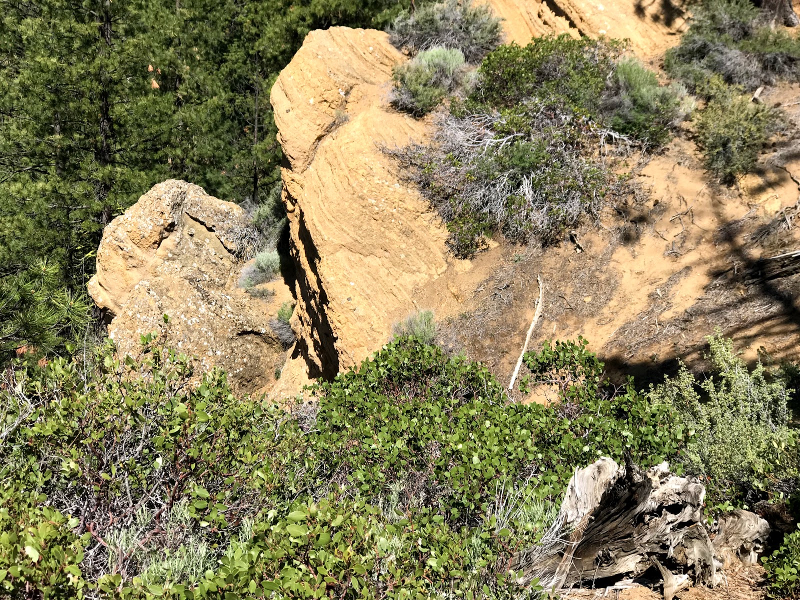
See, it's pretty even if the guy who wrote the book says it's not.

We've talked about doing this hike before, but have never done it. It's too far of a drive to just do this hike, and we've never managed to tie it in with something else for whatever reason. We've only seen it in one hiking book, and the book doesn't put it in the best light. I'm not a huge fan of this book. He gives some inaccurate information as far as distance and difficulty. He apparently also gave some misinformation about the excitement level of this hike. He referred to the hike as having no scenic views and being mainly for people who cared about geology. We found the views to be quite scenic and we really enjoyed the hike. We both said that we were glad that we did it.

This looks like a giant turtle to me. The head is over to the left, and it's shell is the big thing the starts to the right of it. 


You can find it by taking Exit 153 on Hwy 97. You want to go towards Sunriver. That would mean you would go right if you're coming from the north and I would imagine left if you're coming from the south. Take the second exit at the roundabout which is essentially staying straight. A little more than four miles up the road, you'll go left. This will keep you on FS 40. About five miles down the road, you'll see a Wake Butte Trail sign. The sign is on the left and the parking area is on the right. We went in there and drove around the circle, but did not see anything that looked like a trailhead. There were no signs giving any information about the hike or pointing out where to start your hike. We actually left and then went down the road because we thought maybe we were in the wrong place. The book referred to this huge parking area for such a blah hike. We didn't think the circle looked like a parking area at all. We decided to go back in. When we went back in, I saw something that looked like a path. We parked and then inspected it. We decided it was indeed a path. I also pulled out my Pokemon Go app to check out the map since sometimes the trails will show on the map. I was able to see the start of the trail, but then it just sort of died. Then I saw what looked like the trail again after a little bit on the map. We decided to give it a whirl. Worst case scenario would be that we had to go back to the car.


This hike was short. It was less than a third of a mile up, but it was UP the whole way and it was steep! I had to stop several times to breathe and this thing was such a short hike! Based on the description in the book, I thought this would be more like Little Belknap Crater where it was mostly lava rock type stuff and little tree cover. This was pretty well covered in trees. There are giant rocks popping up here and there. At the top, it was gorgeous. With that said though, don't expect to have huge close up shots of the mountains like if you went to the top of Tumalo Mountain. The mountains are pretty far off in the distance. We went early enough in the year that they still had white tips on them so we could tell they were the big mountains versus just the foothills, but it was pretty. We saw a big bird flying around in circles. I'm not sure what kind it was, but he was not cooperating as far as his flight pattern went so the pics weren't that good.

Here's the bird!


There were no bathrooms at this place and we did not see any other people while we were there. We did another hike on the same day after this one, and it's not that far away if you wanted to tie some stuff together. We think this was worth the hike. The second hike we did, not so much! You can read about though if you want. This isn't that far from Lava Cast Forest too. We liked that one too!


There were a ton of Pokemon and I ended up getting a new to me Pokemon while we were there. We sent during the Rock even where the Rock Pokemon were more prevalent than others, but Rock type Pokemon were all we saw. I'm wondering if that area just has Rock type since it's a big rock. :)

Here's the map from Pokemon Go. See the gap there? I think the second part looks kind of like a duck or swan or something that swims on the water.

We didn't hook up my heart rate monitor or run any apps about the distance and elevation. I need to get that going again, but right now, I'm just happy if I manage to make it out the door.


Monday, May 21, 2018

Easy Hike at Lava Cast Forest Trail near Sunriver, Oregon


We got out the hiking books again! This time we were looking for anything tagged as easy and under two miles. We found this hike! We had never done this one before. I'm not sure exactly why, but probably because it was only a mile long and we didn't have enough to bundle it with to make the drive worth it. So this is at exit 153 on Hwy 97. We were headed south from Bend, so we took the exit and then your veer to the left and then turn left. There's an intersection where you go straight and then you just follow the signs to the trailhead. It's mostly dirt, but it was decent dirt. There was some annoying washboard stuff, but it wasn't horrible. The road ends up getting more narrow as you go. After awhile, you'll see a hiker sign, but that's not for this hike. Keep going and you'll get to a trailhead. You can't really miss it because there are big signs on where to park and there's a bathroom. Oddly enough, there's also a PokeStop and a Gym for Pokemon Go in the parking lot. We had cell service the entire way and there were a ton of Pokemon. There were several PokeStops along the trail. I got my second Ditto here! It was great because I needed a Ditto for my special research quest. Okay enough about Pokemon.


So the trail was paved the whole way. It started off wide enough for two people across. After awhile, it got more narrow and it indicated that it was no longer handicap accessible. The path was decently maintained. There were some cracks, but they did circle some potential hazards circled in yellow paint to draw attention to them.


So the background of this place is that a long time ago there was a volcanic eruption. The lava flowed through the area. As the lava surrounded the trees, it hardened before. When the trees rotted away, there were all of these tree molds in the lava. There are a bunch of big circles that look kind of like fire pits to me. It's where the trees were when the lave hardened. There are also some other geological things that I don't know the technical names for, but the place is cool. We went in May. It was a bit chilly in the morning, but it warmed up as we walked around. There was still snow in a couple of the holes. The path is mostly flat, but there was a part that dipped down and then went up and then down and then up again as you made it to the parking lot. There was also a second Pokemon Go gym in the middle of the trail. I think I drove my husband crazy with all of my Pokemon go catches.


I'm really rambling at this point. I'm waiting on my pictures to upload so I can add some pictures. Oh back to the whole we went in May topic. There was still snow in some of the holes and nothing had really bloomed yet. I think the next time we go, we'll try in June or even early July and see if we can get some flower pictures. We love wild flowers! We did see some really pretty birds. One was a really nice blue. It was at the top of a dead tree. My husband pointed it out to me and I was totally oblivious to it. I just couldn't see this bright blue bird on top of this red tree. Not sure exactly what was going on, but I wasn't expecting blue when he mentioned the bird. I'm used to drab colored birds around here. Although, I have been noticing more and more pretty birds. We also so one bird taking a bath in a puddle. I tried to get a video, but I wasn't fast enough. Hubby took over the camera at one point and started experimenting with B&W pics. I've included some of them so you can appreciate his creativity.


Overall, this was a good experience. We only saw one other couple while we where there. It's not something that I would make a really long driver to go see, but there are other things in the area to see while you're there. There's an Obsidian Flow trail. We did that one before, but it was before I had the blog, so I can't remember much about it and I don't have anything to link back to in order to remember. There's also Paulina Falls and all the other Paulina stuff. We've done some of that too, but before the blog. We've also done the walk around the top of Lava Butte, but again that was before the blog so I can't link to anything. We were going to do another .3 mile hike to the top of some other butte I can't remember the name of it. Maybe it was Wake Butte. I'm not sure. All I remember is there is some interesting geology stuff there, but we opted to put it off. We also found out that there's another mile long hike in this area. The trail sign that I mentioned before is for Hoffman Island Trail. I don't know much about it, but it's supposedly a mile and 100 feet in elevation.


I'm still waiting on the pics to load, but it will be awhile, so I'm going to go eat lunch.

Sunday, May 6, 2018

Easy Hike to Benham Falls south of Bend, Oregon

We've done this hike before, but apparently never blogged about it, so here goes. I haven't been blogging much which drives me crazy. I think my last post was in September. I really need to get back to this on a more routine basis. I like writing and I like sharing my experiences with people. I hope someone might find a hike that they might night have done otherwise. It's also nice to have a log that I can go back to and see how hard a hike really was for me. There are some that I remember were absolute hell or some that weren't so bad, but the ones that aren't quite so memorable, it's nice to have this to fall back on.

This hike is easy to find. Just head south of Bend, Oregon and look for the sign directing you to the Lava Butte visitor center thing. It's south of the High Desert Museum and it's on the opposite side of the road. If you're heading south, it's on your right. Once you turn right, follow the Benham Falls signs. At the end, there is a parking lot. Once you're at the parking lot, head to the water and follow the trail to the right. You'll follow it along and go over a bridge. It's narrow until you get to the bridge. The bridge is wide and then the path gets wide as well. It's pretty flat, and the ground is pretty level without many rocks. The hike it about a half a mile according to the sign at the trailhead.


Don't do what we did the first time we went! When you're getting pretty close to the falls, you can hear them and there is a little spot where you can walk down closer to the river so you might think you're at the falls because it has this little fence thing that looks like, "Hey come over here and see this!" It's not "the falls" so just keep going. There is a Pokemon gym down there though if you're into Pokemon. The place was loaded with Pokemon. It also had two gyms. Once of the gyms was up by the bridge and that's where the two Pokestops were also. Anyway......keep walking....


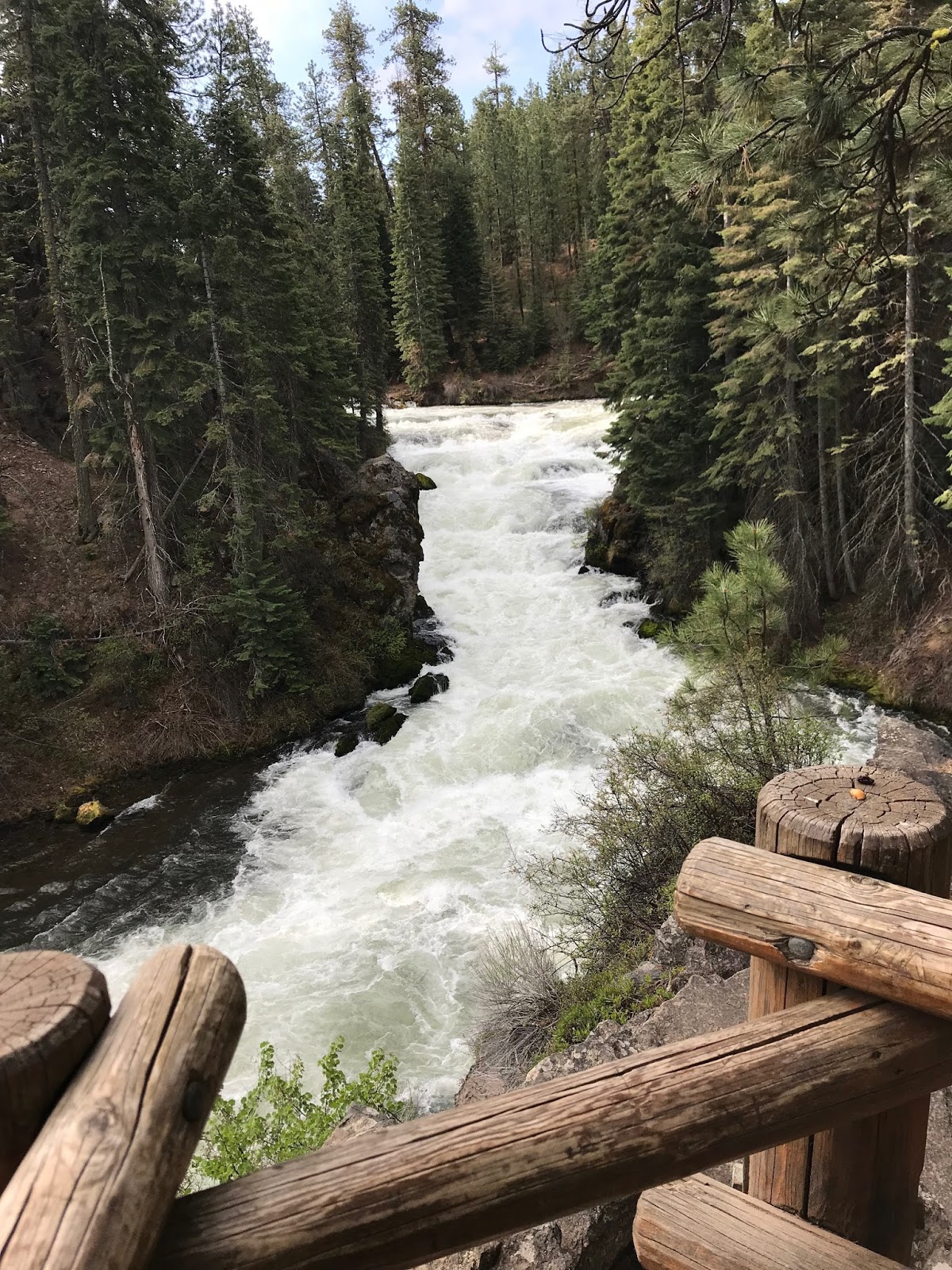
You'll see a vault toilet building and a parking lot. If you want to just come see the falls and not have to walk to get to them, you could figure out how to park here. We don't know how to park here though and we like the walk. You can walk up the steps that you see as you head to the parking lot and then walk down the switchbacks to the overlook or you can keep walking to the parking lot and take the switchbacks there. It's a little downhill to the overlook, but it's really not bad. It's a narrower trail down there also. This waterfall is more of a set of rapids than it is a waterfall. I think it's a 40 foot drop, but it's 40 feet spread out so it's not like you see water coming over a cliff like a traditional waterfall. It's still pretty. People have died going through the rapids in kayaks. There's a log jam by the bridge, so it would be hard to go through them by accident. You'd have to put the kayak in in a place you're not supposed to be anyway.


After you spend five minutes looking at the falls, just turn around and head back. We saw either two deer or the same deer twice. There were a lot of birds and there was a cute little squirrel in a tree. There were also a ton of Pokemon. I'm back to playing Pokemon to try to get me to walk more. We did the little offshoot to get down to the Pokemon gym. I've managed to stay there for 5 hours and 47 minutes so far. I haven't gotten kicked out of the log jam gym yet either. I guess I'm not surprised because I just don't imagine many people go there to play Pokemon. However, the place is loaded with the critters. I went in with 130 red balls and left with like 10! Some of that is because I had bad aim while walking, but let's just not talk about that part.

So I've rattled on for longer than it probably took to do the hike. Part of that is because I'm waiting for my pictures to upload to Google Photo so I can load them. It's been a few months though since I backed them up soooooooo it's taking it's sweet time. If you're in the area, this is worth seeing. You can make this a much longer hike as well. You could park in the same lot and walk to Dillon Falls which is another rapids and not a waterfall. I think it's 7 miles from the parking lot to Dillon Falls. We've been to Dillon, but we did it from the other side and started at the Meadow Park or whatever it's called.

I took a video, but I can't get it into the blog right now. We didn't get a pic of the deer because they took off before I was able to get the camera out.

Sunday, September 3, 2017

Easyish Hike to White River Falls near Tygh Valley, Oregon


We finally went on a hike! My physical therapist told me that I had to hike this weekend, so we did! We drover over an hour to get there and over an hour to get back, and it was only a 30 minute hike, but whatever! It was a new to us location and it had a waterfall! I absolutely loved this waterfall! They call it a two tier water fall. You can see the big tier at the top of the pic and the smaller one at the bottom of the pic, but there are also some mini tiers too so, it's a pretty impressive place. Hubby wasn't as excited as I was over it though. The pic he saw online had water falling across the entire top tier, but there wasn't as much water the day we went so there's the water you can see in this pic above and then some more to the right in the pic below.


The park is about 35 miles south of the Dalles. You'll have to use Google to figure out how to get there because I'm horrible with directions. There was plenty of parking available the day that we went, but I'm not sure what it's normally like there. It was pretty smokey out the day we went. You can see how ugly the sky is in the pic above. The park isn't very big. It's pretty much a parking lot, a bathroom, a couple picnic tables and the trail to the waterfall.


On the way into the park, there was a sign about the mosquito population. It was just a white poster board kind of thing that someone wrote on with markers. I'm not sure who put it up or who keeps it updated, but there were all sorts of revisions about how bad the mosquitoes were. We didn't see any when we went on 9/3/2017.


The bathrooms are normal bathrooms with plumbing and running water! No vault toilets in this state park! There was even a sink with soap. They even had paper towels. There was plenty of toilet paper too! Sometimes, it's the little things that get me excited.


You can see the top tier of the falls from the viewpoint near the parking lot, but you need to walk down the path to see the lower falls. It's worth walking down. It starts off paved, but that doesn't last long. So you switch over to rocky packed dirt. It's a bit steep at times too. It's a pretty short walk down to see the lower falls. I think like an eighth of a mile or so to get you the view for the top pic. From that point, you can see the old power plant down lower. It's another eighthish mile down to the power plan. However, it's horrible stairs and more steep rocky parts to get there. The length of the hike is why I tagged this as easyish. It's super short. It's steep and rocky though. I had my hiking poles. Hubby didn't use his.


We thought we were going to be able to walk around the power plant and get up closer to the waterfall, so we went down the crazy stairs. There was a bunch of Caution Do Not Cross tape up though, so we couldn't get around the building. We really wanted to get closer, but there are people who stay at the park and we were afraid we might get in trouble if we crossed the tape. We're chickens! Oh well. They also had a sign at the beginning of the hike letting us know that we weren't supposed to go to certain area. I totally missed the rattlesnake sign the first time I looked at that one! OMG!


The building was interesting. Hubby got some good shots inside of it, but I didn't take any.


We both were happy that we went and it was a good test for my leg. I did really well in terms of strength and lack of pain. I was so focused on the fact that I couldn't breath so I didn't really spend any time worrying about my foot. Without my hiking poles, I would not have gotten through this one. Hubby did find without his hiking poles. I had to take a few breaks. I wanted to die by the time I got out of there. I felt soooooooo out of shape, but I also felt pretty happy that I was able to do it. 

I forgot to bring my heart rate monitor and I forgot to set up the GPS app on my phone so I don't have an accurate distance or elevation gain/loss. I read somewhere that it was .7 mile out and back with 200 feet of loss then gain, but it didn't feel like .7 so maybe that's if you can get all the way around the building and closer to the waterfalls. The 200 feet might be accurate. 

(I had to edit this page to remove two pictures that weren't working)

Monday, July 4, 2016

Easyish Hike to the top of Carpenter Mountain near Blue River, Oregon


Carpenter Mountain

It wasn't the best day to go to Carpenter Mountain, but we did it anyway! It was an amazing day and there are some crazy pictures that we wouldn't have gotten on a bright clear day. The path was really quiet and we only saw one other couple there. Who else would go to a viewpoint hike on such a cloudy, miserable day! We did get some really cool pictures, but I don't really suggest going to this hike on such a crappy day. We got drenched! It wasn't raining, but the path is very narrow and it's overgrown with bushes. All of those bushes were wet from the previous rain and also just from all the moisture in the air. If you do decide to go on a miserable day, make sure you pack extra clothes! 


So the book said this was a 2.2 mile hike with 900 feet of elevation. We were actually planning on doing a different hike, but they were actively logging that mountain. We could have waited 20 minutes for them to clear the road, but then we could have gotten stuck at the top of the mountain! We decided to bail on that and go to the hike that I actually wanted to do, but didn't think we could do since 900 feet over 1.1 miles sounded steep! I really wanted to try out our new Subaru Forester though and the book said something like "the increasingly rough road." It made me want to do this hike just to play with the car! The car did great on it! We did pretty well on the hike also. 


There's not much to say about the hike. My Polar M400 thinks the hike was only .8 miles up, but the book thinks it was 1.1. I'm not going to argue over the distance. The book said 900 feet, but it didn't feel like 900 feet. We must be getting better at this stuff. We stopped to take a bunch of pictures, but we didn't have to stop many times for breaks. About halfway up, there was a big field with a bunch of wildflowers. It was gorgeous. They had a bunch of hummingbird feeders which seemed odd, but whatever. Hubby saw a hummingbird, but I didn't. The path was really narrow in some spots, bu wider in others. The bush ground cover was probably the first third of a mile, but after that, it was wide enough to get through. 


There's a lookout tower at the top of this thing. I would not want to spend the night in this thing! There's an outhouse, but you have to walk down a scary rock to get to the outhouse. No Thank You! The lookout tower is on the tippy top and to get there, I pretty much crawled up this rock. To get down, I sat on my butt like a toddler going down stairs. It was sooooooo scary for me! 


We loved this hike and we didn't have many problems with it, but if you're just starting out, you might not want to try this one right away. I would also suggest bringing hiking poles for hiking newbies. The top of this thing is seriously scary. Hubby wasn't afraid, but I was! Maybe it's because I keep remembering the time when we went to some mountain and there was this patch of snow. We had to climb up and over it. I went up and almost went over the mountain. I ended up falling and then sliding. Not sure how I managed to stop sliding but I did. Then I was sitting there in the snow thinking, "How the hell am I going to stand up and not fall over this mountain?" I do okay with the up, but I bet nervous on the down. When you're going up, you have the opportunity to try your footing with the foot before you pick up the other foot, but when you're going down, if you miss step, there's not much you can do. The poles help though because you can poke around with the pole to find a good spot and then you've got three points of contact with the ground instead of just one. 


How to get there

If you want directions there, follow this link to traveloregon.com. I'd just end up getting you lost and I don't know if it's okay to copy their directions on here. It's way easier to just link to them.


Overall Comments

There were no restrooms at this location and it's a nice bumpy road there and back. Make sure you find someplace to pee before you go up there and find a quiet place off the path to take care of things before you get to the car. I tagged this as Easyish and the book we used called it Easy. We didn't need to stop for breaks very often and I wasn't in my pain the following day. My calves were sore, but that was it. However, another website tagged it as "very difficult." I wouldn't go that far, but maybe they are trying to keep people safe. This is one of those hikes that isn't really all that easy to classify. I'm 265 pounds and made it up there, but I've been working out and hiking frequently for the past couple years. Use your own judgement on if you think you can handle it. Don't do anything crazy and make sure you wear good shoes. Don't go up there in flip flops! 


Polar M400 Screen Shots

I forgot the heart rate strap. Oh well. The Polar M400 agreed with the book on the elevation. That's a first! 


Gaia GPS Screen Shot

Gaia thinks the hike was a little longer than my Polar M400 and had a little less elevation. I will say though that I know I never moved 4.2 MPH on this hike and it seem to think I did so there's obviously a flaw with it somewhere.