We've done this hike before, but apparently never blogged about it, so here goes. I haven't been blogging much which drives me crazy. I think my last post was in September. I really need to get back to this on a more routine basis. I like writing and I like sharing my experiences with people. I hope someone might find a hike that they might night have done otherwise. It's also nice to have a log that I can go back to and see how hard a hike really was for me. There are some that I remember were absolute hell or some that weren't so bad, but the ones that aren't quite so memorable, it's nice to have this to fall back on.
This hike is easy to find. Just head south of Bend, Oregon and look for the sign directing you to the Lava Butte visitor center thing. It's south of the High Desert Museum and it's on the opposite side of the road. If you're heading south, it's on your right. Once you turn right, follow the Benham Falls signs. At the end, there is a parking lot. Once you're at the parking lot, head to the water and follow the trail to the right. You'll follow it along and go over a bridge. It's narrow until you get to the bridge. The bridge is wide and then the path gets wide as well. It's pretty flat, and the ground is pretty level without many rocks. The hike it about a half a mile according to the sign at the trailhead.
Don't do what we did the first time we went! When you're getting pretty close to the falls, you can hear them and there is a little spot where you can walk down closer to the river so you might think you're at the falls because it has this little fence thing that looks like, "Hey come over here and see this!" It's not "the falls" so just keep going. There is a Pokemon gym down there though if you're into Pokemon. The place was loaded with Pokemon. It also had two gyms. Once of the gyms was up by the bridge and that's where the two Pokestops were also. Anyway......keep walking....
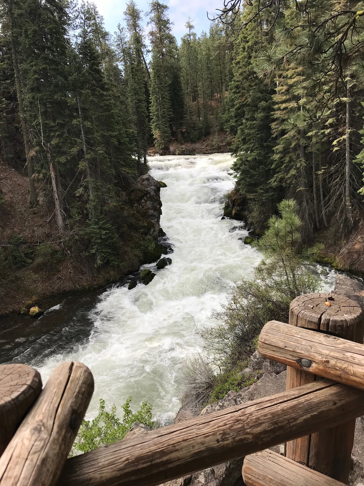
You'll see a vault toilet building and a parking lot. If you want to just come see the falls and not have to walk to get to them, you could figure out how to park here. We don't know how to park here though and we like the walk. You can walk up the steps that you see as you head to the parking lot and then walk down the switchbacks to the overlook or you can keep walking to the parking lot and take the switchbacks there. It's a little downhill to the overlook, but it's really not bad. It's a narrower trail down there also. This waterfall is more of a set of rapids than it is a waterfall. I think it's a 40 foot drop, but it's 40 feet spread out so it's not like you see water coming over a cliff like a traditional waterfall. It's still pretty. People have died going through the rapids in kayaks. There's a log jam by the bridge, so it would be hard to go through them by accident. You'd have to put the kayak in in a place you're not supposed to be anyway.
After you spend five minutes looking at the falls, just turn around and head back. We saw either two deer or the same deer twice. There were a lot of birds and there was a cute little squirrel in a tree. There were also a ton of Pokemon. I'm back to playing Pokemon to try to get me to walk more. We did the little offshoot to get down to the Pokemon gym. I've managed to stay there for 5 hours and 47 minutes so far. I haven't gotten kicked out of the log jam gym yet either. I guess I'm not surprised because I just don't imagine many people go there to play Pokemon. However, the place is loaded with the critters. I went in with 130 red balls and left with like 10! Some of that is because I had bad aim while walking, but let's just not talk about that part.
So I've rattled on for longer than it probably took to do the hike. Part of that is because I'm waiting for my pictures to upload to Google Photo so I can load them. It's been a few months though since I backed them up soooooooo it's taking it's sweet time. If you're in the area, this is worth seeing. You can make this a much longer hike as well. You could park in the same lot and walk to Dillon Falls which is another rapids and not a waterfall. I think it's 7 miles from the parking lot to Dillon Falls. We've been to Dillon, but we did it from the other side and started at the Meadow Park or whatever it's called.
I took a video, but I can't get it into the blog right now. We didn't get a pic of the deer because they took off before I was able to get the camera out.
We finally went on a hike! My physical therapist told me that I had to hike this weekend, so we did! We drover over an hour to get there and over an hour to get back, and it was only a 30 minute hike, but whatever! It was a new to us location and it had a waterfall! I absolutely loved this waterfall! They call it a two tier water fall. You can see the big tier at the top of the pic and the smaller one at the bottom of the pic, but there are also some mini tiers too so, it's a pretty impressive place. Hubby wasn't as excited as I was over it though. The pic he saw online had water falling across the entire top tier, but there wasn't as much water the day we went so there's the water you can see in this pic above and then some more to the right in the pic below.
The park is about 35 miles south of the Dalles. You'll have to use Google to figure out how to get there because I'm horrible with directions. There was plenty of parking available the day that we went, but I'm not sure what it's normally like there. It was pretty smokey out the day we went. You can see how ugly the sky is in the pic above. The park isn't very big. It's pretty much a parking lot, a bathroom, a couple picnic tables and the trail to the waterfall.
On the way into the park, there was a sign about the mosquito population. It was just a white poster board kind of thing that someone wrote on with markers. I'm not sure who put it up or who keeps it updated, but there were all sorts of revisions about how bad the mosquitoes were. We didn't see any when we went on 9/3/2017.
The bathrooms are normal bathrooms with plumbing and running water! No vault toilets in this state park! There was even a sink with soap. They even had paper towels. There was plenty of toilet paper too! Sometimes, it's the little things that get me excited.
You can see the top tier of the falls from the viewpoint near the parking lot, but you need to walk down the path to see the lower falls. It's worth walking down. It starts off paved, but that doesn't last long. So you switch over to rocky packed dirt. It's a bit steep at times too. It's a pretty short walk down to see the lower falls. I think like an eighth of a mile or so to get you the view for the top pic. From that point, you can see the old power plant down lower. It's another eighthish mile down to the power plan. However, it's horrible stairs and more steep rocky parts to get there. The length of the hike is why I tagged this as easyish. It's super short. It's steep and rocky though. I had my hiking poles. Hubby didn't use his.
We thought we were going to be able to walk around the power plant and get up closer to the waterfall, so we went down the crazy stairs. There was a bunch of Caution Do Not Cross tape up though, so we couldn't get around the building. We really wanted to get closer, but there are people who stay at the park and we were afraid we might get in trouble if we crossed the tape. We're chickens! Oh well. They also had a sign at the beginning of the hike letting us know that we weren't supposed to go to certain area. I totally missed the rattlesnake sign the first time I looked at that one! OMG!
The building was interesting. Hubby got some good shots inside of it, but I didn't take any.
We both were happy that we went and it was a good test for my leg. I did really well in terms of strength and lack of pain. I was so focused on the fact that I couldn't breath so I didn't really spend any time worrying about my foot. Without my hiking poles, I would not have gotten through this one. Hubby did find without his hiking poles. I had to take a few breaks. I wanted to die by the time I got out of there. I felt soooooooo out of shape, but I also felt pretty happy that I was able to do it.
I forgot to bring my heart rate monitor and I forgot to set up the GPS app on my phone so I don't have an accurate distance or elevation gain/loss. I read somewhere that it was .7 mile out and back with 200 feet of loss then gain, but it didn't feel like .7 so maybe that's if you can get all the way around the building and closer to the waterfalls. The 200 feet might be accurate.
(I had to edit this page to remove two pictures that weren't working)
We've done this hike twice before, but we needed a short hike that we could do on the way to Albany. We like to redo hikes periodically to see how much improvement we've had. The first two times we did this hike were quite challenging for us. It's only 3/4 of a mile, but according to my map, it's more than 400 feet in elevation over that 3/4 of a mile. My GPS watch actually showed it as just over a half mile too so that's a shorter distance to cover that same elevation which means.........this thing is pretty steep at times.
The trailhead for this hike is in the Cascade Park in Cascadia, Oregon. There's a vault toilet here and a campground.
The hike starts off level for a minutes and then you climb uphill. It gets steep in parts, but is flattish in parts. If you're in shape, you could probably get up there without stopping to catch your breath. We're overweight, so we stopped a few times, but not nearly as many times as we did the last time we went up. We went pretty early and it was a bit cool. It was still humid beyond believe, but that's the valley so that's what happens.
We did this one without our poles. We had intended to bring them, but we left them in hubby's car by accident. No worries though. I was sort of glad to go up without them just to compare this trip to the last time we went up. We got up there in about 25 minutes, which was faster than before and we got down in 17 minutes which was about the same as before I think. I wore the backpack this time. I don't remember if I did last time. We didn't end up using anything from it though which was a bit annoying. The more annoying part was that I discovered the camera battery was dead once we got to the trailhead sign and I tried to take a picture. My options were to run back to the car and put us at risk for getting to Albany late or just carry the weight around. I carried the weight around. It's good practice right?
There wasn't a whole lot to look at during the trip up. It was green mossy trees. There were a couple flowers, but it was a pretty bland walk this time. The trail was soft in spots, slippery in spots and muddy in spots. There was one tree across the path that we had to step over and there was one tree that we had to go under. It's hard going under the trees with my backpack on.
We got through it. We felt good about it and we'll probably try this hike again next year and see how things go.
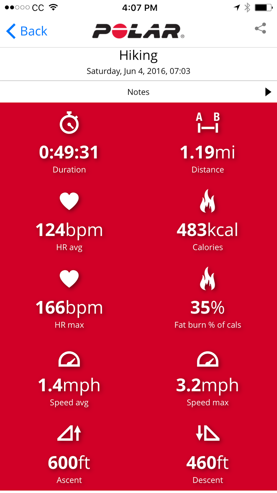
Polar M400 Screen Shots
There's a weird dip in my heart rate before the last big push to go up that hill. Not sure what happened there, but I'm pretty sure my heart rate didn't magically go that low. You can see the times we stopped by checking out either chart.
It was Memorial Day weekend and we both had Saturday off together! I didn't have any editing projects to work on and we didn't have to go to Albany. We got up early and went to Bend for breakfast and grocery shopping. When we got home, we decided to change our clothes and head for a hike picked this one. I'm glad he did because it was an amazing waterfall, but wowzers it was a doozy to get to.
This is the trailhead sign. You need to fill out a permit, but this isn't the pay station.
We found the hike in a book called Bend, Overall. It's not really near Bend, but whatever. No one is keeping score here. The hike was supposed to be just over 5 miles, but we didn't do the full hike. If we had followed the hike in the book, we would have gotten to see one more lake and one more water, but we opted out after we saw the first waterfall. If you're new to the blog, you might not know that I'm a 263 pound, 40 year old woman. I've been doing this whole fitness journey since about January of 2014. It's my latest go at this losing weight thing. I've tried it before and lost some, but then gained it back. One of the reasons I want to stick with it this time is so I can get outside and enjoy what Mother Nature has to offer. Hikes like this are my reason for wanting to get in shape. I don't care if I'm skinny. I just want to be strong enough to make it to places that other people don't get to so I can take pictures of things. Ultimately, I'd love to create my own lines of calendars and write a book to help people like me find places to hike. I'm getting off topic, but I think it's important to talk about this before I get into the particulars of this hike.
Not really sure why there were two trailhead signs, but there were.
Our version of this hike was about four miles. What the book doesn't mention is that we started off going uphill right away. I am never a fan of hikes that start off going up hill. I like to warm up a bit before I start climbing a mountain. It wasn't a steep incline or anything, but it was pretty much two miles up hill. There were a couple parts where it leveled out a little bit and even a couple spots where we got to go downhill for about five seconds. We took a lot of breaks! The terrain was mostly soft packed dirt. It wasn't really hard and it wasn't super sandy. There were plenty of rocks along the path. After awhile, we got into a lava flow area and the path was pretty much all rock. There were a few "river crossings" along the way. They were about a foot wide and we just stepped over. We didn't have to actually go through the water. They weren't really rivers. They were pretty much snow melt run off I think. Later in the summer, they might all be dry.
Eventually, you hit Lake Ann. It's a pretty small lake as far as lakes go, but it's still plenty big enough for a bunch of people to be out there floating around. Some people were on the shore fishing. Several people along the trail had fishing poles and one guy said that he had heard from people at work that there was great fishing in the area. We're not sure if he was referring to Ann Lake or Marion Lake though.
The book we had said that there was a junction and in the path and we needed to count 213 steps after the junction and then find a faint path. The first "junction" we came to was a trail off to he left that went along Ann Lake. We weren't sure if that was the junction in question or not, but we hadn't hit 1.6 miles yet which is where the alleged junction should have been so we kept going. At about 1.6 miles, we ran into what was obviously the junction in question. There was a sign post indicating Marion Lake was straight, and the Marion Outlet was to the right. We took the Outlet because that's what the book said. After 213 steps, we hadn't found anything that looked like a trail. I thought that we should keep going since I was assuming our stride would be shorter than a person who was more physically fit than us and we were going uphill so our steps were shorter than normal. We found it about 230 steps. The book indicated that it was a faint trail and difficult to see. Maybe someone made it more obvious after the author was there, but we found it fairly obvious. However, it might not have been so obvious had we not been looking for it since we had gone past our 213 steps. Anyway, I've included a picture of what to look for between 213 and 250 steps depending on your stride.
This is what you're looking for between 213 and 250 steps from the junction.
Okay so then we followed this not so well used trail. There were several trees down so we had to go over them or around them whichever was appropriate at the time. This is the kind of hiking that hubby likes. I'm okay with it as long as he's in the lead since I get lost easily. He had me in the lead though. I'm usually in the front for a couple reasons. The main reason is just habit from the old days when I was the out of shape one. He had me go in front so I could set my own pace. I like being in the front because people can't sneak up on me from behind since hubby is there to protect me. I'm super rambly today with my posts!
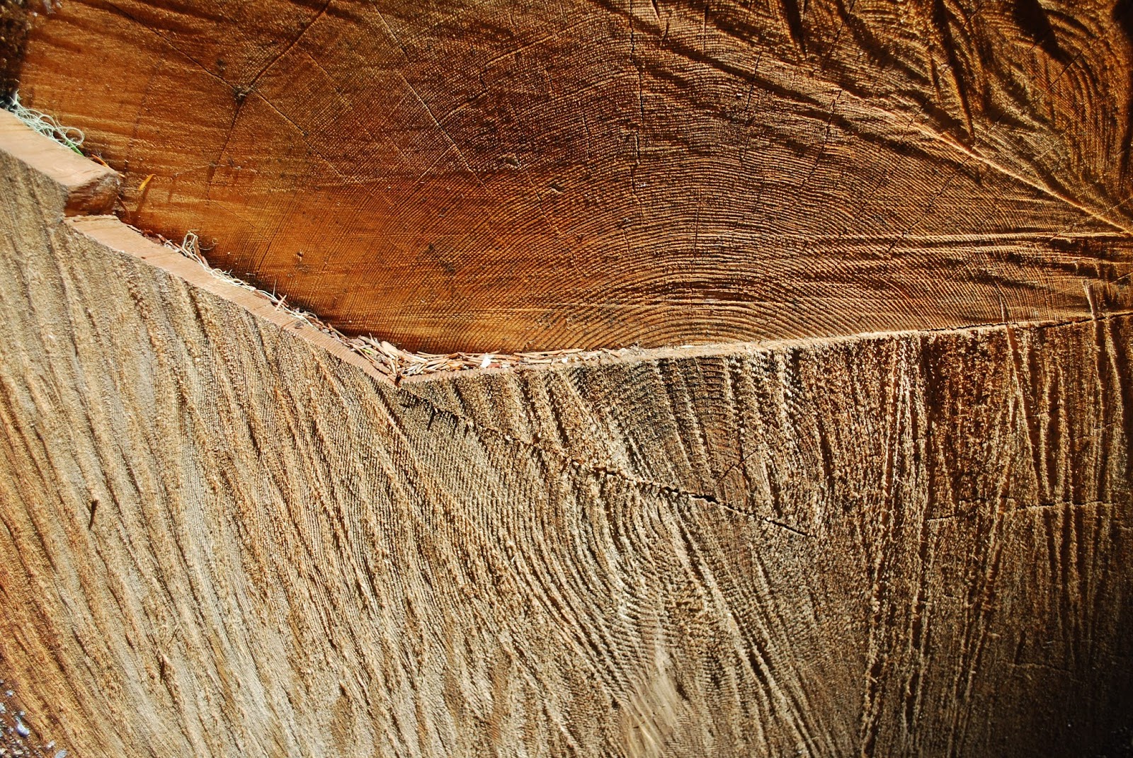
I love the textures in this tree. Check out the perfect circle growth rings in the center!
Anyway.......We just sort of followed the "path" until we got to the waterfall. You're on top of the falls at this point. So once your on the rocky thing above the falls, if you go up to the right a bit, you can see what looks like at one time might have been a path. It's narrow and it's steep! The book referred to it as a 3 minute scramble. It took us longer than three minutes to get down. So we thought we were at the bottom, but it turns out, we were in between the two sets of falls so we could see the upper falls and the pool, but we couldn't see the lower falls. The upper falls was gorgeous and the trail to it was scary enough so we opted to bail on the lower falls and come back another day. I can't wait to go back, but it will probably have to wait until next spring and we'll just have to hope we don't have a drought this winter. There was a ton of water coming over the upper falls and I'm sure the lower falls was absolutely gorgeous! I'm wish we had one of those drone cameras so we could have flown it down and gotten to see it without having to hike down to it! That's so going on my Christmas list!
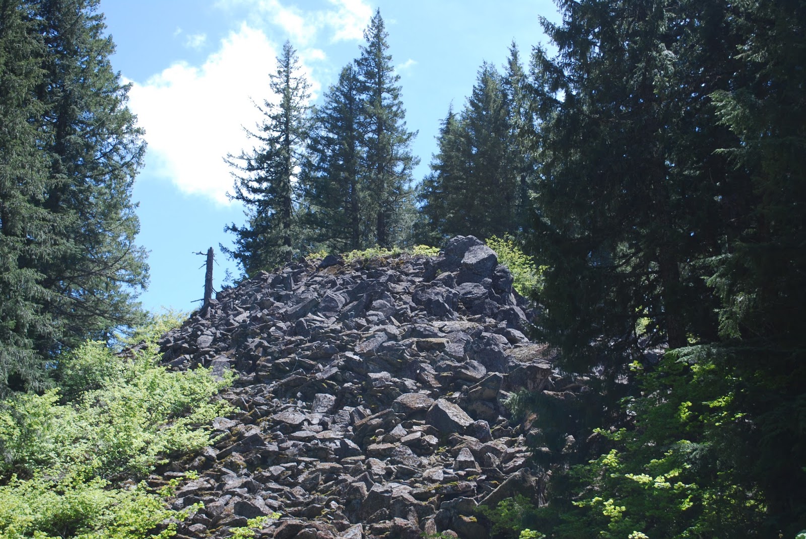
This is the lava flow that I mentioned somewhere.
The "three minute" scramble down to the waterfall, was the second scariest hiking experience we have ever had. I honestly wasn't sure if we were going to make it out of there because it was pretty dang steep and it was pretty slippery in spots. I'm not really sure what possessed me to actually go down there! The only hiking experience that was scarier than this was the time I slipped on the snow pile we were crossing and I almost went over the edge of a mountain. I most likely would have died had I gone over. I don't think I would have died if I had slid down on this since there were enough trees around me, I think something would have stopped my descent. (Back to rambling again.)
This is Ann Lake. It looks small in this picture, but it's only about half of the lake.
Getting out was actually easier than getting down into that area. We stopped a couple times, but we made it out without incident. The funny part though is at one point, I said to hubby that I thought we were almost out and he said we still had like 2/3 to go. I'm like, "Okay. I must just have a bad concept of time." So then we get up further and take another break. I recognize the super steep part we started our descent at and I tell him he just needs to get to the top of that steep part and we're good. He's like, "No, we're like halfway." I'm like, "Okay. Just keep going." He gets to the top of the steep part and he shouts back that it's the top. So, it really wasn't that bad getting out. It was bad, but not that bad. I don't really recommend anyone going down there unless you're in shape and have hiking poles. We made it, but it was stupid and could have resulted in a helicopter evac. It didn't, but that doesn't mean it was a good idea to go down in there.
Here is the bear grass that I mentioned at some point.
We thought that we just needed to get out of that section and we'd be going back down hill again, but apparently this stretch was uphill both ways because we were going uphill again! We finally got back to the part close to the Outlet trail and went back downhill again. From there, it was pretty much downhill until we got to the car. It was the longest exit of my life! I don't really know why, but this was never flipping ending getting out. We didn't stop very many times, but we didn't do our normal 3MPH pace on the way out either. Neither one of us had the leg strength to be hauling butt getting out of there. By the time we got to the car, I was soooooo ready to just go home!
Here is a picture of a rhody that I mentioned at some point. They all seemed to be this color. I'm not sure if others bushes are different varieties that just hadn't bloomed yet.
Overall Thoughts
I loved the waterfall that we saw and Lake Ann was great too. Next time, we'll make it to Marion Lake and hopefully get to see the lower falls as well. There is also another waterfall about a mile down the road from this one. We'll stop by and see that one next time too. If I had known it was so much uphill from the start, it might not have seemed so tedious. There wasn't a whole lot to look at along the trail. You can only take so many pictures of broken trees, giant root systems and tree ring patters. We went on May 29th. The rhododendrons were just starting to bloom. There was also some bear grass. I would imagine that the trail gets absolutely gorgeous once all the rhododendrons are blooming. The place was pretty busy. The parking lot isn't that big, but there is a big grassy space before the parking lot that is easy enough to park in. We had to walk about a 10th of a mile from where we parked to get tot he trailhead and it was all uphill which meant it was all downhill to the car! YAY!
How to Get There
Take Marion Lake Road in Marion Forks, Oregon. It's pretty much across the street from Marion Forks Restaurant which was closed when we got done with the hike. Otherwise, we would have stopped there for dinner, and I would have written review about that! I'm going to start writing reviews about restaurants at some point. So go down the road about 4.3 miles. The third waterfall that I mentioned earlier is on this same road. As you're heading to the Marion Lake Trailhead, there's a green gate to the right off the road a bit about 3.3 miles from HWY 22. The book didn't really say how far past the gate it was until the waterfall, but the book is usually vague. It's highly annoying.
This is the junction you're looking for. Head to the right and count out your 213 to 250 steps depending upon your stride.
Restrooms
There is a vault toilet set up at the trailhead. Ann Lake did not have a restroom. I'm not sure if anything is set up a Marion Lake.
Fee Parking Area
You have to pay to park here. It's $5.00 a day or you can use the NW Forest Pass. It appeared that there was a pay station at this location. It's not at the trailhead though. Before you get to the parking area,there's a station that appeared to be the fee station. We didn't stop though since we had a NW Forest Pass already.
This is one of the giant root systems that I mentioned. Both of us love to look at the roots of the trees that have fallen over. It's amazing how something with all of those roots holding it in can just topple over. They even pull the rocks out of the ground when they go over.
`Polar M400 Screen Shots
Here are the screen shots from the Polar M400 Heart rate monitor and GPS watch. I found more things to screen shot! How exciting! The stats are a bit messed up because I forgot to hit stop until we had driven about 3/4 of a mile away so my max speed is a wee bit out of wack. I definitely did not walk 25.6 MPH. The elevation is out of wack partially for the same reason. We went up and then came down so the up and down should be the same, but there's an extra 300 feet down since we were driving back to hwy 22. I'm not sure that I believe the 1520 feet ascent though. The book seemed to think it was closer to like 700ish feet of elevation. It felt more like 700 to us. I'm not sure if it got out of wack because we lost the GPS while going down to the waterfall. I was really interested in seeing the elevation map for this one, I thought I would be able to see the steep descent to the waterfall and ascent out, but it's not showing it. There is a giant dip, but that's when it lost signal I think. I know we didn't go all the way down to sea level.
It was interesting seeing the topographical map. I hadn't noticed that on the app before. The green hiker symbol is where we parked the car. Everything to the right is the hike. Everything to the left is driving out.
This is the screen I'm used to seeing with the ma view. I wish I had gotten Marion Lake all the way in the picture so you could see the size different between Ann Lake and Marion Lake.
If you've been to this spot before, please drop a comment below and let me know what you thought about the experience.
We're running out of hikes to do along HWY 22 and HWY 20 between Sisters and he valley. We decided to do this one even though we thought it would be too much elevation for us. The book has it listed as 640 feet. Turns out it was the easiest 640 feet we've ever done and so worth the walk!
How to get there
Take HWY 22 from Salem towards Detroit. After just over 22 miles, turn left at a flashing yellow light. The road is called Fern Ridge Road. It's paved. You drive down this road for a little over a mile and a quarter. There's a small parking lot on the right. It's pretty small, so you should get there pretty early for this hike.
The Hike
This hike goes through open cow pastures, so if you're afraid of cows, you might not want to do this hike. For the most part, we never smelled the cows, so don't let that keep you from doing this hike. It starts off going uphill, but it's a very gradual uphill. We didn't need to take breaks and we were able to continue talking throughout the whole trip to the first part of the falls. We got a lot of pictures of the cows! Some of them just stared at us, but most of them didn't even notice us. The trail starts off pretty wide. It also has several cattle guards on it. Most of them have boards you can use to go over them if you don't want to walk over the metal slats.
I think it's about a mile to the first waterfall. You can't really see much of it from this angle, but you'll see it better when you loop around. We went up the stairs to the upper falls first. After doing the hike, we both agreed that this was the best way to go. The trail changes to more of a narrow hiking trail through the forest. It got a bit steeper going through this section. I'm pretty sure it was about a half mile to the waterfall the turn off. The stairs weren't too bad. Before you get to the waterfall, you can go down a side path to the left to a viewpoint for the waterfall. You really should go down there. It's downhill so you have to come back up, but it's worth it.
After you take your fill of pics, head back from the viewpoint and head towards the waterfall. You can go behind it and get more pictures. I love it when you can go behind the waterfalls! There was a bench behind the waterfall too so it was a great resting spot. If you're tired, get some rest because the trail is about to get steep!
After you pass the waterfall, you get to deal with more steps. The steps were a bit steep, but we made it! Follow the path until it hooks up with a road again. At that road, go right. You'll start going downhill in a bit. It's a pretty gentle downhill. Keep an eye on the left for several rocks. I think it was about a half a mile or so. Walk through the rocks and follow the path about a 1/4 of a mile I think. (We did this hike a month ago and I thought I could use my map, but it doesn't have distances on it!) Okay, so follow that down and then path forks to the right and you can see Stassel Falls. This is on private land so don't go off the path.Get your fill of pics and head back the way you came. Then go left when you hook back up with the road so you're going the same direction as you were before you took the offshoot to Stassel Falls.
You'll end up at the lower falls. There's a picnic table there if you need a rest. You can get a decent shot of the falls from this side. After you have your fill of pics, just head past the gate and back to your car. Some of the cows probably won't have moved! They are quite the interesting little things.
Stassel Falls
Restrooms: None
There are no restrooms at the trail head, but if you go left out of the parking lot, (heading away from Salem), there is a rest stop a couple miles down the road. It's worth going out of your way for the potty since there aren't many options for bathrooms heading towards Salem.
Overall Thoughts
We LOVED this hike. I love waterfalls in general, so if there's a waterfall, I'm pretty much going to love the hike. I really loved this one though. There was elevation, but it was all so gentle except a few small sections near the falls. We got to see three different waterfalls on a relatively short hike. The weather was great and it was so much fun walking through the cow fields! We'll be back at this waterfall for sure. We went during a drought year. We really want to see this one during a heavy snow year during the spring snow melt!
Lower Falls
Polar M400 Screen Shots
This one didn't have a crazy calorie burn on it, but it also didn't take that long to do. According to the screen shot, we did this in an hour and 46 minutes, but I still had auto pause turned on. I don't know how long it really took with the breaks and stuff.
Gaia GPS Screen Shot
I got a new app for my phone. It's called Gaia GPS. It's $19.95, which is the most I've ever paid for an app, but I love how it lays out the altitude, so I'm okay with the price. It saved me from having to buy a handheld GPS unit. I'm not sure if I'm completely thrilled with the app though because the miles show crazy numbers usually. I keep meaning to put my phone someplace other than my pants pocket to see if maybe a different location will help.




 , I would not have gotten through this one. Hubby did find without his hiking poles. I had to take a few breaks. I wanted to die by the time I got out of there. I felt soooooooo out of shape, but I also felt pretty happy that I was able to do it.