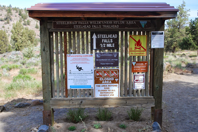
Steelhead Falls Wilderness Study Area - Steelhead Falls Trailhead
Today, we went to Steelhead Falls in Crooked River Ranch. The book we used and the trailhead both say that it's a half mile to the falls, but it seemed like more and MapMyHike thought it was a little longer as well. Halfway there, we realized that I didn't have hiking shoes on. I was wearing my Stegmann clogs. You should really check them out. They are awesome shoes, but they are not shoes to go hiking in! We decided to keep going and see if I could handle it. The book said there was a steep half mile. I decided to use my hiking poles and was pretty happy for that decision.
How to get there
On HWY 97 north of Terrebonne, turn left onto Lower Bridge Rd for Crooked River Ranch. You'll stay on this road for about 2 miles. At which point, you'll turn right onto 43rd. After almost another 2 miles, go left on Chinook Rd. After a mile turn left onto Badger Rd. About a mile and a have after that, turn right onto Quail Rd. Then a mile later turn left onto River Rd. It will turn to gravel. You'll pass a couple of headstones on the right and then you'll hit the parking lot.
After a little bit, the trail starts to descend. There are bits that are pretty steep. I was thankful for my poles because I slid several times! Without my poles, I probably would have landed on my butt.
There were parts of the trail that were pretty narrow and we had to pull off when people came through. There were also some spots that were pretty side. A few spots had big rocks in the bath.
The trail was along the river the whole way. I love walks along the river. Even if there isn't a waterfall to get to or a scenic destination, a walk along a river is just amazing. Listening to the water is wonderful. The view along a river is constantly changing.
We were starting to think that we had gone the wrong way because we felt like we had gone more than half a mile, but we decided to keep going and were glad that we did. I love this water. It's not really tall, but there's just so much going on. You've got the fish ladders on the side and then you've got the main waterfall in the middle. Even in the middle there are like three different sections to it. It's hard to see in the picture but between the big part in the middle and the small part to the right is a small waterfall. It looks like water coming out of a pipe. It's pretty interesting to see because you've got all of this rushing water to the left and then this little trickle coming out to the right.
The color of the water was pretty awesome. You can't really see it in the pictures, but it looked amazing in person.
Overall Thoughts
This trip was well worth the hike. The trip to the falls is doable even if you're overweight and out of shape. If you have any type of injuries that make inclines difficult though, you might want to skip it. If you're overweight and out of shape, just take is slow. Go at your own pace. This is definitely worth the effort to get to. I was pretty shocked that we only stopped two or three times getting out. A year ago, the trip getting out would have taken us a lot longer. It's such a short hike that the steep spots aren't so bad.
Restrooms
I think it's important to know if there are restrooms when you're going on a hike! This hike had restrooms at the trailhead. I didn't use them, but I'm assuming they were just the normal vault type toilets that they have at most trailheads.
MapMyHike
I only have the MapMyHike screen shot for this one. I forgot to have Runtastic end the workout so it shows like 5 hours and 23,000 calories burned and a lot of miles covered. Oopsy. I couldn't get Walkmeter to start at the trailhead and hubby was getting antsy. Fortunately, MapMyHike actually saved the hike! I'm not including a screen shot for BodyMedia for the calories burned because according to the app, I got a whopping 3 minutes of total activity today. I walked a mile and half according to MapMyHike and BodyMedia thinks I was sitting on the couch eating BonBons. We walked pretty slowly though because of my shoes and the loose footing. Looks like we did about 200 feet of elevation change on this hike according to the map here.


No comments:
Post a Comment