

Where we went and why
Today, we went back to the Oregon Badlands. We went there for the first time on February 1st of this year and did the Ancient Juniper Trail. This time, we set out to see the petroglyphs. We found out about the petroglyphs from reading Bend, Overall. It's a hiking guide for Bend, Oregon and the surrounding area. My husband wanted to see the petroglyphs and we both wanted a flat hike, so we went with this. There are a lot of trails in this area. You can see the map of the whole Oregon Badlands Wilderness. To get to the trail head that we used, go east on HWY 20 from Bend. Around mile post 17, take a left onto the road marked as the Badlands Rock Trailhead. Don't park in the first parking lot by the road. Keep going to the next one.

The Walk
From the trailhead, we walked .3 miles to the signposts. We went right at the signpost. The footing was similar to beach sand,but it wasn't quite as bad as walking on the beach. The path was pretty side and we could walk side by side easily. The trail was pretty flat.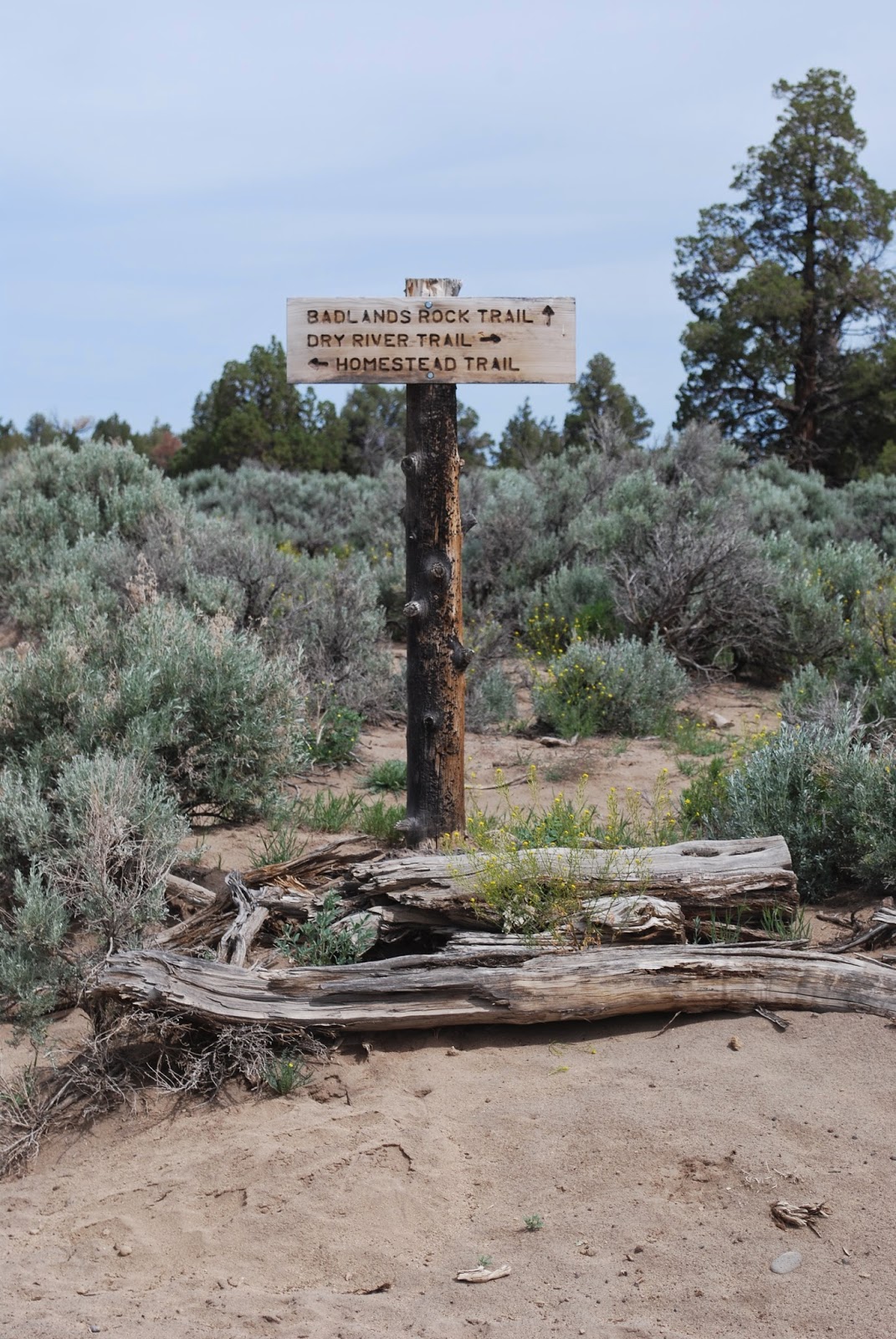
The book said to go 1 mile on this trail and turn right when you see three rocks blocking a trail. Unfortunately, it didn't mention that you should pass by four rocks that are blocking a path. We saw the four rocks and thought maybe someone had added a fourth rock so we went right. We walked down and around and then referred back to the book. We then walked some more. We saw a lot of pretty flowers and a lot of rocks and trees, but we did not see a rock overhang. We finally wandered around enough to find a dry canyon. We then realized that we should be down in that dry canyon. My husband, the adventurous one, said, "I wonder if we can get down there from here." I immediately realized that the only way that I was getting down there would be as I fell to my death. I promptly vetoed the plan to even attempt it.

We followed the "trail" back to the main trail and then consulted with MapMyHike to see if we could figure out if we had passed the correct path that we needed to take. We decided that we had not skipped it, so we kept going on the main trail. After several minutes, we found the correct three rocks and took a right. We then took another right and were right in the dry canyon that we had seen from above. The footing here was still pretty much like beach sand. We walked pretty slowly through this section since we had no idea how far into the dry canyon this overhang would be. We saw a lot of small caves that little tiny people could fit in, but didn't see anything big enough for anyone to use for shelter. We saw something that looked like it would make a great pizza oven, but again, no caves big enough for people.

Then, we saw it! My husband saw it first and then we knew that the rest of the "caves" we had seen weren't really caves. This thing was big. We were able to walk into it. Then we hunted for the petroglphys. We only saw a couple of things. Only one of them really looked like something. It was red and looked like a stick drawing of a person. It was to the right of the cave opening. There were other red marks on the rock, but they didn't look like anything. It was more fun actually finding the cave, than it was looking at the petroglyphs.

After we had our fill of the petroglyphs, we continued down the dry canyon to make a loop of our route. The path got pretty rocky and my husband had to pull me up a couple of times since I don't do well rock climbing. After we got out of the narrow rocky part, it opened up and the trail became pretty faint. The book said to head southeast, but we weren't really sure which way that was. Fortunately, my husband noticed the compass attached to my backpack. He used the compass and guided us to safety.The footing was back to beach sand.

We eventually found the fence that the book referred to. We went right and followed the fence. Once the fence ended, we weren't sure which way to go, but we referred to MapMyHike and veered to the left along the fence. We followed that for a bit and then followed the trail that no longer hugged the fence. We kept walking even though we felt like we were going in the wrong direction. Eventually we veered to the right again. If we had stayed straight, we would have ended up meeting up with the road we had driven on. By veering right, we cut off a corner and went right to the parking lot. However, there wasn't really a trail there after a few yards. We were walking through the wildflowers.

Overall Thoughts
I wouldn't suggest going here on a hot day. There was a breeze for us, but there isn't much cover, so you're in the sun the entire time. There were no restrooms at this trailhead and no places for water so empty your bladder before you arrive and bring plenty of water to keep hydrated. I wasn't fond of the footing because it made it more of a strenuous hike than it really was, but I did enjoy the walk. I loved all of the wildflowers and had fun taking pictures of them.

The Video
If you liked the pictures and want to see more, check out the YouTube video with more!
BodyMedia Screen Shot
I'm pretty bummed that MapMyHike requires Internet access at the end of the hike in order to save the hike. I had the most interesting map going since we took the wrong path and then went off wandering. Oh well, live and learn. My BodyMedia app wouldn't work before the hike so I don't have the workout tab either. I do have the calories per minute chart thing from BodyMedia, but that's all I have. I really wanted to know how many miles this was! I think it was about four, but that's just a guess. We walked pretty slow at times since we were looking for the cave. We walked for about two hours, but I only got just over an hour for moderate activity and I didn't get any vigorous activity. It was a nice time out with my husband, so it's all good. We weren't trying to break any land speed records. Plus, both of us had blisters on our feet from yesterday's walk along the Deschutes River Trail. Well, I had a popped blister from yesterday, and he had a growing blister from yesterday.

No comments:
Post a Comment